Short history of Langsett
Ye limber-lads of Langsett whose fathers were renowned
For hunting of the brown hare on this wild mountain ground;
You may deem them homely-fashioned, their simple life decry,
But they lived a happier span, lads, than either you or I.
Songs of a Moorland Parish (with one alteration) Ammon Wrigley (Kenworthy, J., The Early History of Stocksbridge and District, Handbook No. 16, 1915)
Langsett is a small, upland village that has been designated as a Conservation Area. It is located in the valley of the Little Don, or Porter River, within the South Riding of Yorkshire. It is also positioned within the Dark Peak area of the Peak District National Park, an area of dark millstone grit and expansive moorland on the edge of Pennine Yorkshire. The land rises gently to the north and west of the settlement but to the south, it falls away sharply towards the reservoir. Its elevated position means that views into and out of the village are a significant part of its character. Views, and glimpses of views, to the south over the reservoir are spectacular, being predominantly landscape and water. These have a strong effect on the overall character and setting of Langsett, which is provided by a mixed landscape of open fields to the north, woodlands to the west and the expansive reservoir to the south, while over 100 square miles of moorland stretch away to the south and west. The moorland is a mosaic of blanket bog and dry heath, one of the world’s rarest habitats.
The first written reference to Langsett, referred to at the time as Langside or Lanside, was in approximately 1190 when the manor was held by Kirkstead Abbey in Lincolnshire. The name is thought by some to mean ‘long hillside’, ‘referring to the long steep slope on the north side of the Little Don valley’. Another definition is ‘long slope’, or ‘side’ of the great pen (an ancient term for ridge or hill), originating from the custom of taking livestock to the higher slopes, during the summer months, up the lang side (long slope) and the winter grazing on lower land.
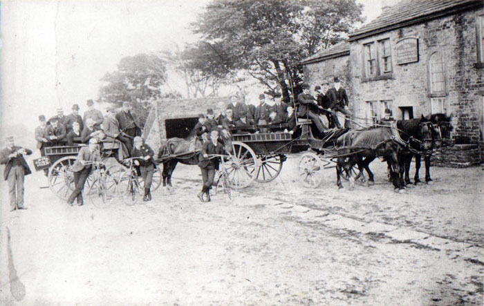
Langsett is therefore a very ancient settlement that, although it did not appear in the Domesday Book (1086), was subsequently named in a charter granted in 1290 by Edward the First to Elias de Midhope. There is also some evidence that a manor, with its hall, once existed here. However, there appears to be little archaeological evidence pre-dating the medieval period within the confines of the Conservation Area boundary. The oldest buildings remaining in Langsett are Langsett Barn and the barn located north-west of the Lodge, both listed buildings dating from the 17th century. A number of farmhouses in the Conservation Area originate from the 18th century. The few notable 19th century developments comprise the Waggon and Horses Public House and the Lodge. Elsewhere in the Parish, however, one of the oldest buildings is the Dog and Partridge situated on Bord (or Board) Hill, an ancient inn situated on the medieval trans-Pennine trading and coach route that linked Cheshire and Lancashire with various towns and cities in Yorkshire (now the A628), with a history that can be traced back to the Elizabethan period.
|
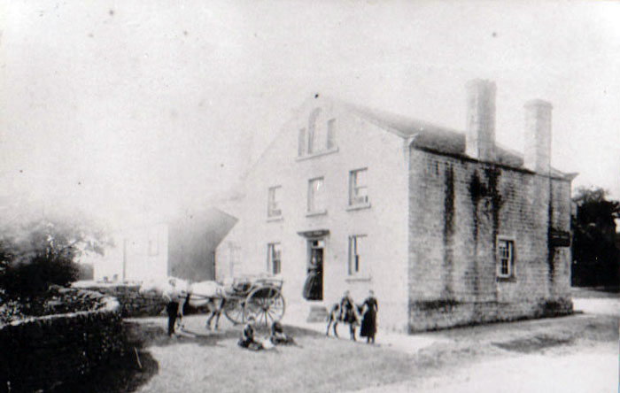
The Wagon and Horses |
|
The Dog and Partridge on Bord Hill |
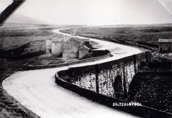 |
Saltersbrook Bridge on the old trans-Pennine route leading to Langsett |
Back to Top
|
Historically, agriculture formed the basis of Langsett’s economy. This was supplemented by small-scale industries, such as coal mining and stone quarrying and, over the centuries, these industries have not only been part of the economic backbone of the settlement but have also shaped its layout, built framework and its surrounding landscape. Until the end of the 19th century, Langsett was predominantly an agricultural settlement and the agrarian lifestyle had a significant impact on the settlement determining the types, arrangement and development of plots and buildings. Enclosures and the remnants of open-field cultivation demonstrate that land around Langsett had historically been used for arable as well as pastoral farming.
|
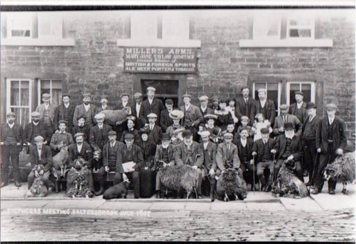
Local shepherds gathering at Saltersbrook |
However, land in and around Langsett is quite poor and it is therefore probable that low intensity pastoral farming, primarily sheep farming, prevailed. Historically, therefore, many of Langsett’s farmers had to take on other work to supplement their income and some of the local farmers would have probably also worked in the local coal drift pits and gritstone quarries. There are even records of a coal-mine within Langsett, which is likely to have been at the Bullhouse quarry located immediately north-east of the village.
|
The Church at Langsett |
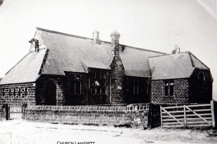
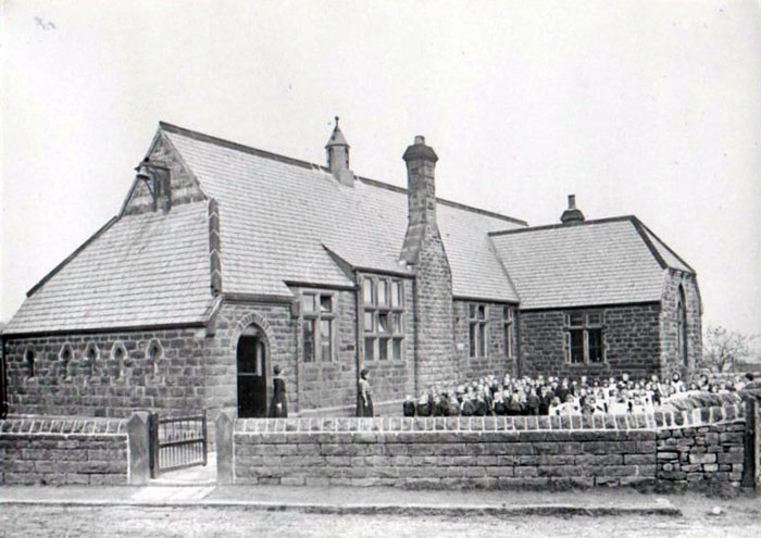
A church and school were opened in Langsett in 1875 (both probably closing in the mid-20th century). At this time, moorland to the south of the settlement, in the ownership of the Pilkington family, was utilised for grouse shooting. It is highly probable that some of the inhabitants of Langsett were employed by Pilkington to support this leisure pursuit - e.g. as beaters and gamekeepers. However, the Parish of Langsett, which was established in 1894, went through its most significant transformation when the dam and reservoir were constructed at the end of the 19th century because of an increased demand for water in the towns of South Yorkshire as a result of industrial and population growth.
|
Langsett School Exterior
|
|
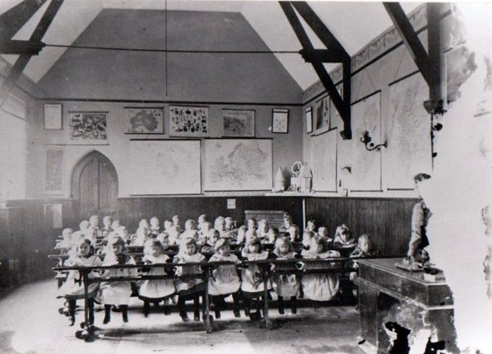
Langsett School Interior
|
Back to Top
|
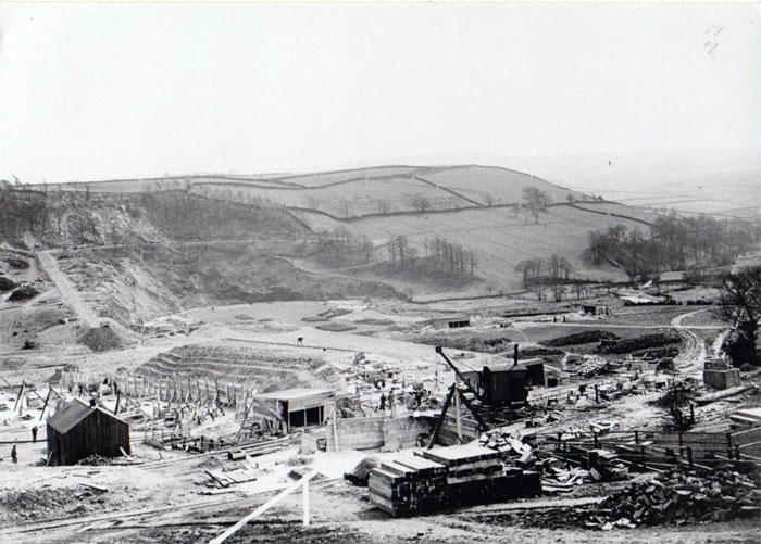
The valley of the Little Don or Porter and its tributaries were seen as an ideal location to site a reservoir funded by Sheffield, Doncaster, Rotherham and Barnsley Corporations. Sheffield Corporation Waterworks purchased the reservoir site and neighbouring farms from the Pilkington family and work commenced on the dam in 1898. Before drinking water was chemically treated, the water draining into reservoirs had to be as clean as possible and farms in the reservoirs’ water catchment area were seen as a source of contamination. The Sheffield Corporation Waterworks therefore pursued a policy of farm depopulation in the surrounding area and many farms were abandoned, including five farms in the area of Swinden Lane, an ancient green lane connecting Langsett with Bord Hill, the last of which was occupied until the 1930s.
|
Langsett during the construction of the reservoir |
The village’s appearance and its setting were therefore both transformed as a result of the construction of the reservoir, and the population dramatically increased with the arrival of large numbers of labourers brought in to build the dam. Work started on Langsett, Midhope and Underbank reservoirs in 1889 with the aim of supplying water to Sheffield and Barnsley. Langsett Reservoir dammed the Little Don River, which runs through the valley where Langsett is situated, and when the reservoir was officially opened in 1904, it was the largest of the Sheffield reservoirs and had the longest road on a dam in the United Kingdom.
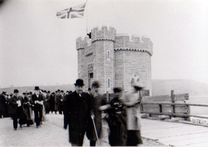
|
Opening Day, 17 October 1904 |
Once the dam was completed, the labourers moved out of Langsett, although many of their former shelters remained in-situ until after World War II. After this comparatively brief period of activity, therefore, the settlement reverted to its predominantly agricultural lifestyle, although villagers from Langsett and Midhope were also employed in the water industry. In 1974 the Yorkshire Water authority took over ownership of the reservoirs and in 1989, the water industry was privatised and ownership passed to the present owner Yorkshire Water Services Ltd. The Langsett water treatment works were built in the early 1980s to replace two older water treatment works at Langsett and Midhope and in 1985, water started to be supplied from the works to the south-west side of Barnsley and the north-west side of Sheffield.
Much of the land around Langsett is therefore still used for sheep farming. The sheep, which are mainly Swaledales, are a hardy breed capable of surviving on the moors or on rough grazing nearer to farms. They are ‘hefted’ to an area of moorland, which means that they stay there by instinct and don’t need to be fenced in. The ewes have their lambs in April or May and are brought down from the moors in June to be sheared, and then again in October for tupping. However, the moors have also been used for grouse shooting for over 100 years. Shooting was very popular in the Victorian era when there were many ‘gentlemen of leisure’ who could spend time and money on such country pursuits. At that time a day’s shooting would cost £13. Now it costs £17,000 or more. In terms of bringing income into the area, shooting is more important than farming.
The income from grouse shooting helps to pay for the management and conservation measures. Combined with sheep farming, managing the moorland to increase the numbers of grouse available for shooting maintains habitats for other wildlife, such as the golden plover. Management of the landscape is necessary to preserve the beauty, wildness, openness and sense of history that visitors enjoy. The land around Langsett is nearly all privately owned, and therefore management is by agreement between the landowner and the National Park Authority. Heather moorland is a semi-natural habitat. Without careful management, overgrazing by sheep would lead to the destruction of heather and its eventual replacement by scrub and birch woodland. The moors to the west of Langsett Reservoir are therefore grazed by sheep but are also managed by gamekeepers for grouse shooting. As part of this management, the heather is burnt in small patches at five-year intervals to encourage the growth of new shoots for the grouse to feed on and predators are controlled so that the grouse will thrive.
As well as their important role as a resource for water gathering, wildlife habitat, farming and game shooting, peat bogs store large amounts of carbon. It is estimated that Peak District peat bogs store between 16 and 20 million tonnes of carbon. More carbon is stored in UK peat than in all the forests of the UK and France put together. When damaged, by erosion, fire or pollution, peat bogs release their stored carbon. Protecting peatland areas can help to retain and capture carbon thereby helping to reduce the impacts of climate change.
Today, Langsett is ideally placed for visitors from Stocksbridge and Penistone, and the area is easily accessible from the large cities of Sheffield, Huddersfield and Manchester. It is therefore an easy drive to Langsett for millions of people who wish to spend a day in the countryside. According to a survey carried out by Yorkshire Water, the main reasons why people visit the Langsett Reservoir are good walking (37%), to appreciate the beautiful scenery (27%) and for peace and tranquillity (9%). Following the coming into force of the countryside and Rights of Way Act, 2000, there is access to most of the open moorland surrounding the valley, along with a network of bridleways, easy access (suitable for disabled visitors), concessionary and public footpaths.
Langsett Barn, which was restored in the late 1980s by the National Park Authority, Barnsley Metropolitan Borough Council, Yorkshire Water, Langsett Parish Council and the Countryside Commission (now Natural England), is set in woodland next to Langsett Reservoir. The restored barn provides a village hall for Langsett, with a ranger centre, car park, picnic site and toilets (including for wheelchair users) also being provided for visitors.
Sources:
Kenworthy, J., (1915) The Early History of Stocksbridge and District, Handbook No. 16.
Peak District National Park Authority (2010) Conservation Area Appraisal, Langsett.
Peak District National Park Authority, Langsett Valley, Fact Sheet 15.
Stocksbridge and District History Society,
http://www.stocksbridgehs.co.uk/ (accessed 21.10.13)
All the photographs on this page are owned by, and are copyright of, Langsett Parish Council.
.