Area Geography
Geology of the Area
The area around Langsett is part of what is described as the dark Peak. The rocks under this area are the gritstones (Millstone Grit) and shales. These rocks were deposited in the Carboniferous period, around 250 - 280 million years ago. At this time the land formed part of a huge river estuary flowing from what is now the highlands of Scotland. The sands washed down by the river formed the gritstones and the mud in the river estuary formed the shales.
The hard gritstone rock has been exposed by wind, rain and river action to form isolated rock formations. In other places the shale is exposed.
On top of the gritstone is a thick layer of peat. This has been formed over thousands of years by the rotting vegetation in the area.
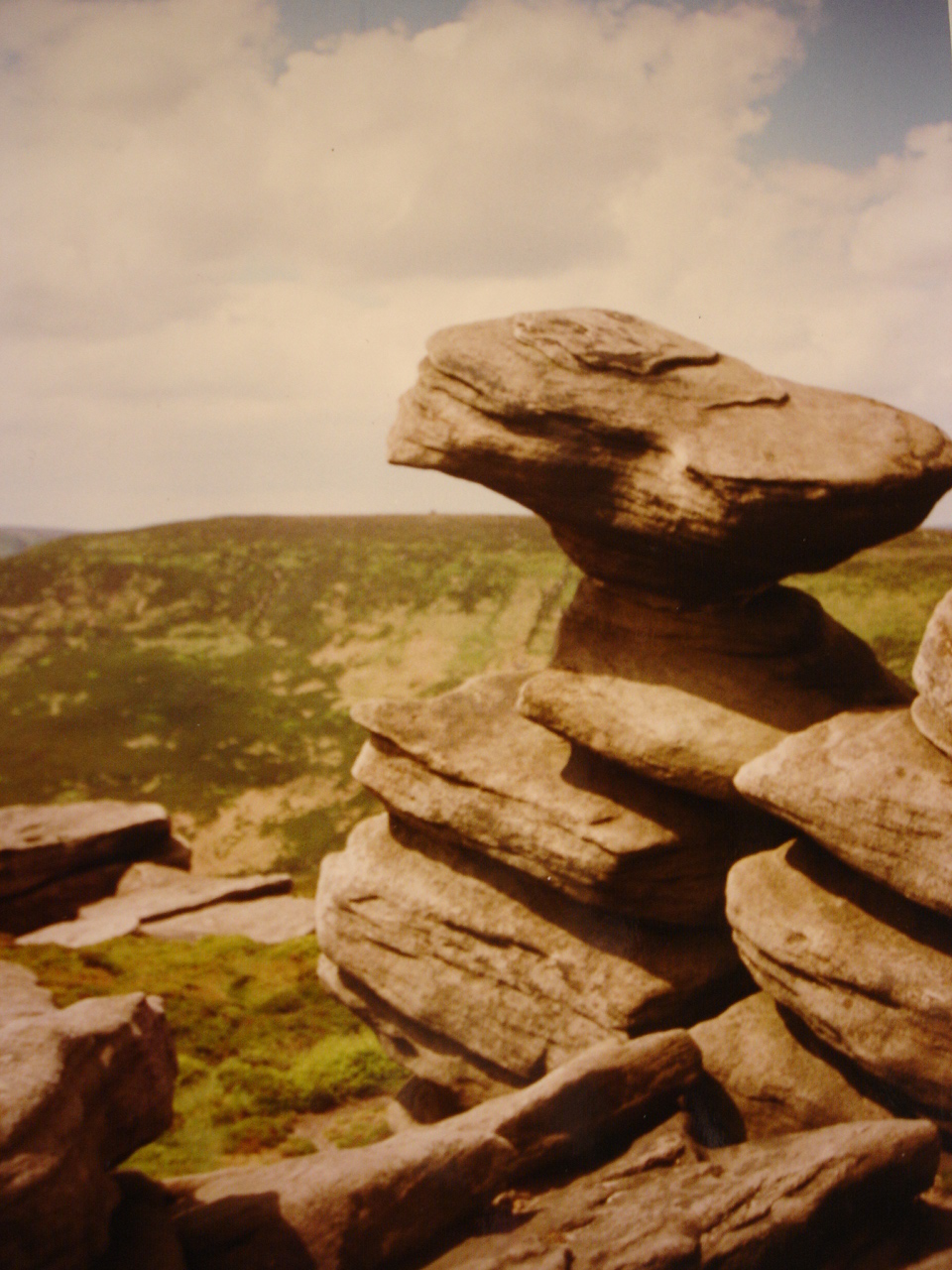 |
| Millstone Grit Formation Langsett |
Natural Vegetation
Thousands of years ago the Dark Peak was covered by forest. Evidence of the forest can be seen where the small tributaries of the river have cut deeply into the peat and exposed old roots and trunks which had been covered by the peat for thousands of years.
Eventually all the forest was removed and other vegetation took its place. This was mainly grass, heather and bracken. In some places there are also bilberry and cloudberry.
The area around Langsett would have had this sort of vegetation cover from the time that settlement of the area is first recorded. The land would have been mainly used for sheep grazing.
Although the heather cover is part of the natural vegetation, without the present management of the heather it would be encroached by bracken and grass and much of the heather would be lost.
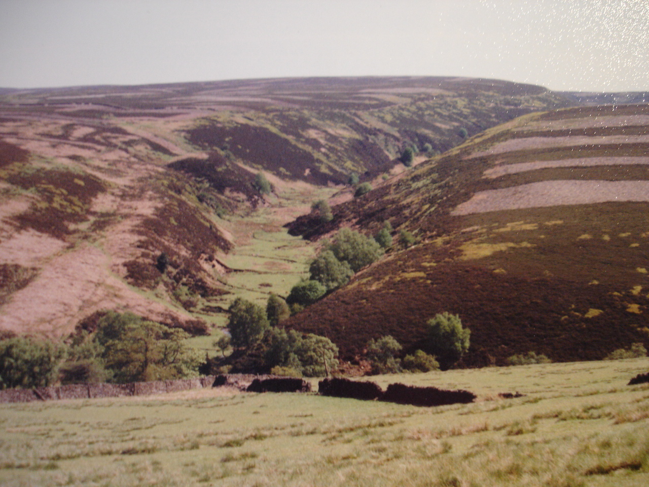 |
| Natural Vegetation of Langsett Moors |
Guide Posts, Signposts and Milestones
Until the 18th century there were no signposts to guide travellers. Often boundary markers were used as guide posts. In this area a number of crosses would have been used as guide stones.
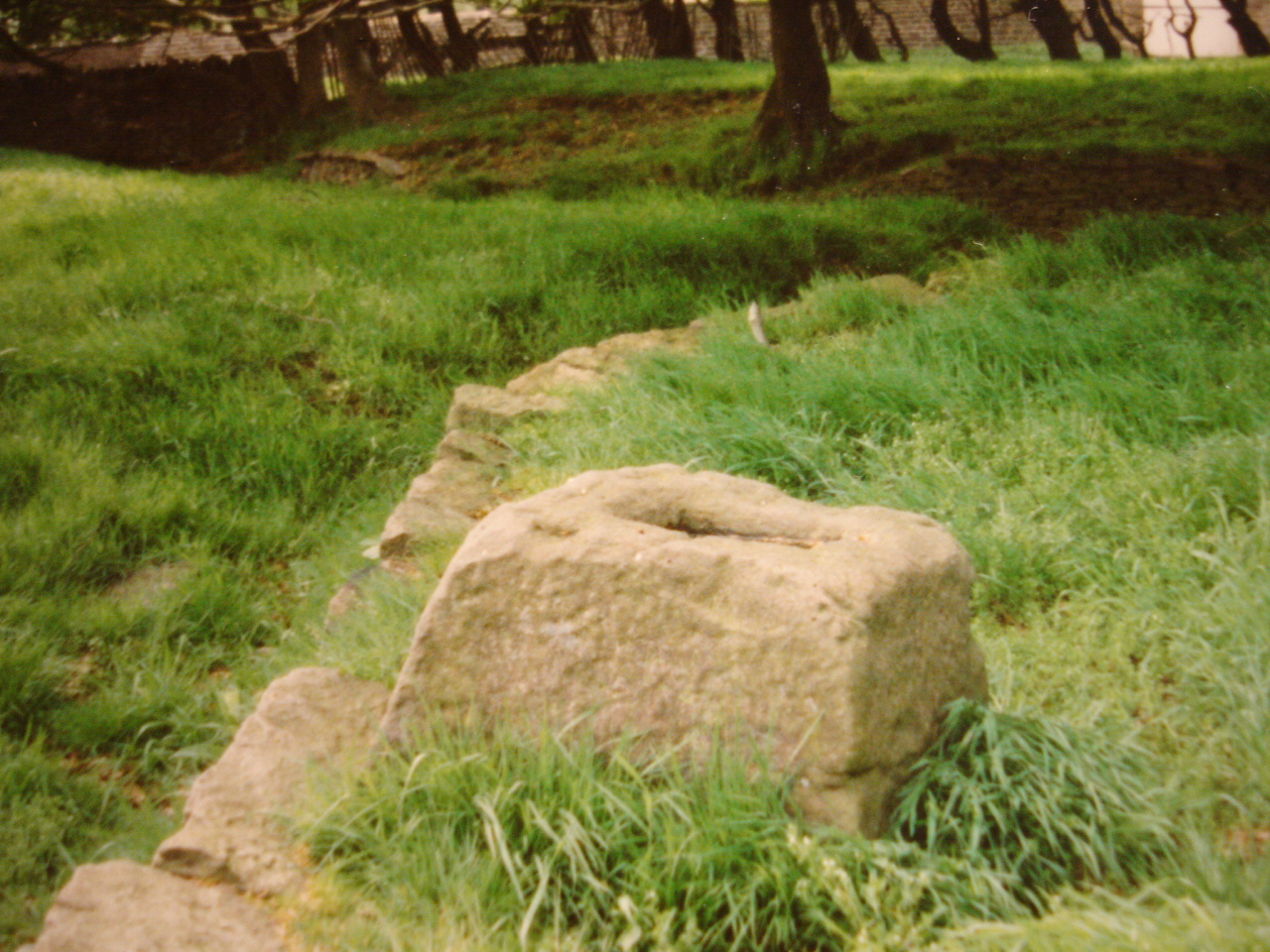
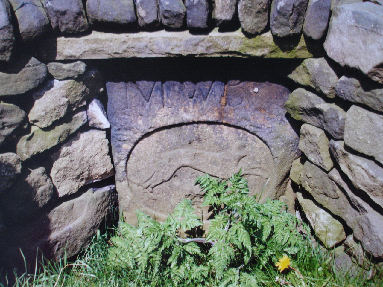
Lady Cross was first recorded in 1274 and was most probably erected by the monks of Basingwerk Abbey as a boundary and wayside cross for their extensive Glossop estate. The monks of Kirkstead Abbey, to show the boundaries of their pre 1271 estate, probably erected Bord Hill and Fulshaw and Hartcliffe crosses. Near the Hartcliffe cross is the greyhound stone. This stone would also have been used as a guidepost.
However it was not until 1702 that Parliament decreed that routes had to have signposts. Before that it was a matter of local knowledge as to how to get from one place to another.
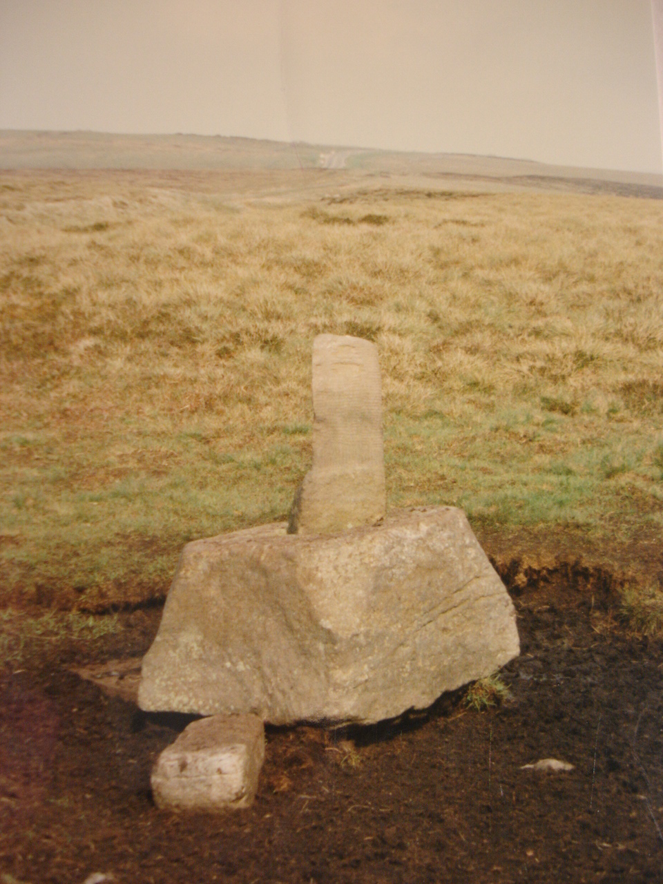 |
| Lady Cross |
 |
| Bord Hill Cross |
 |
| Greyhound Stone |